|
| *****SWAAG_ID***** | 316 |
| Date Entered | 06/11/2011 |
| Updated on | 07/11/2011 |
| Recorded by | Tim Laurie |
| Category | Tree Site Record |
| Record Type | Botanical HER |
| Site Access | Public Footpath |
| Location | Birkdale.Stone Houses |
| Civil Parish | Not known |
| Brit. National Grid | NY 859 010 |
| Altitude | 365m |
| Geology | Chert and sandstone strata above the Main Limestone |
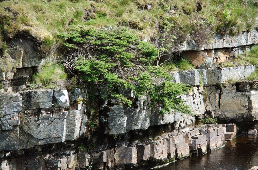
| Record Name | MUK105 Birkdale Beck. Stone Houses. Isolated Juniper. |
| Record Description | Low cliff at stream level. South facing.
Site Type A with Juniper (1), Rowan, Sallows and other Willow spp.
|
| Dimensions | N/A see photos |
| Geographical area | Upper Swaledale |
| Common / Notable Species | Juniper
Rowan
Willows
Vegetation not yet recorded. |
| Additional Notes | This isolated juniper shows signs of distress,with much bare stem showing despite being unaccessible to stock or rabbits. |
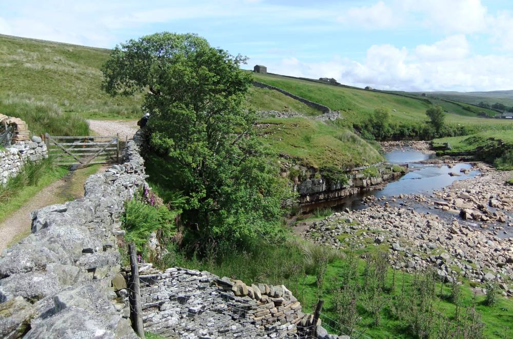
| Image 1 ID | 1166 Click image to enlarge |
| Image 1 Description | Birkdale. Stone Houses. Birkdale Beck becomes the Swale downstream from here. Note vegetated cliff further downstream, not recorded yet. |  |
| Image 2 ID | 1167 Click image to enlarge |
| Image 2 Description | Isolated Juniper on low sandstone cliff with rowan. |  |